The design of the Tasmap 1:50 000 Map Series provides a clear and accurate portrayal of topographic information, with symbols and map content giving enhanced depiction of buildings, hill shading and a simplified classification of vegetation.
John Brierly is one of the acknowledged experts in walking the pilgrim’s route of the Camino Frances, Way of St. James, or Camino de Santiago, in northern Spain. For walkers who do not wish to carry the full guide book, and who only require maps, John has produced this map kit, with full daily stage…
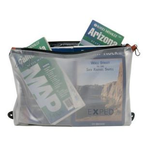
Perfect for travellers, this Vista Organiser pouch from Exped is durable and water resistant to help you keep documents, electronics and valuables protected in your luggage. The body is made of a translucent 75D double laminated TPU film and polyester mesh with taped seams, and the YKK zipper is a weatherproof design to further minimise…
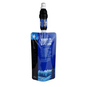
Given the amount of enquiries we fielded, we just had to start stocking the Sawyer Water Filter Systems. The Squeeze is their classic filter: lightweight, compact, durable and simple to use. Instructions:
These are the official 1:25 000 scale topographical maps from the NSW government Land & Property Division, covering the most outstanding areas of the state on a well-produced, reversible, fold-out map perfect for hikers.
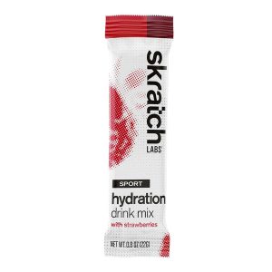
Skratch Labs Sport Hydration Drink Mix Strawberries was created for a simple purpose – to replace the electrolytes lost in sweat and to provide a little bit of energy when working out, without offending your palate or gut.
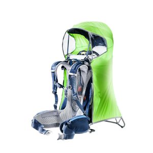
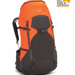
The WBA is a lightweight, full-sized pack that lives up to its moniker: it Weighs Bugger All! This top-loading rucksack has a 65 litre capacity (medium) and is made from Diamondloc with a Cordura nylon base, weighing less while providing functionality through clever design. The EXACT FIT harness is supportive and comfortable both on- and…
A compact map of Queensland (QLD) at a scale of 1:2,500,000 from Hema, for touring throughout the state which features highways, major roads and minor roads. Marked on the map are national parks, camping areas, caravan parks, rest areas, points of interest and 24-hour fuel accompanied by a distance grid and an index.
This is one of a series of excellent guide books from the Cicerone. Their guides are an inexpensive option for hikers heading all over the world looking to explore the world’s best walks and treks, mountains and cycle routes. This book covers the Japan Alps, featuring 27 walks and treks in the North, Central and South Alps, and…
Skratch Labs Clear Hydration Drink Mix is a sports drink that tastes like water with a twist of lemon. Drink Clear when you just want to drink water but know you need a sports drink. Clear is infused with a subtle hint of flavor from real lemons to give you a crisp, light tasting, refreshing way…
Hema’s regional map of Mid West Western Australia covers from Cape Range National Park south to Mandurah and as far as Kalgoorlie at a scale of 1:1,250,000 that has camping areas, national parks, fuel supplies and facility symbols marked on the map.


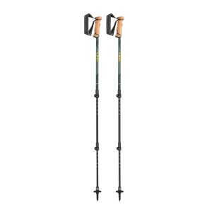 Legacy Lite Anti Shock Walking Poles - Pair
  Cradle Mntn Lake St Clair and WOJ
  Western Australia State Map
  Pacific Crest Trail
  Trekking Annapurna
 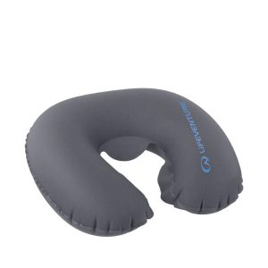 Inflatable Neck Pillow
  Ranger Ms
  Expedition Ms