The Grampians region is one of the most popular destinations in Victoria for bushwalking and outdoor recreation. This detailed topographic map contains the latest road and walking trail networks, and in depth info for walking, overnight hiking, 4WD touring and other recreational activities. The map also includes a detailed inset of the Mount Abrupt and…
The design of the Tasmap 1:50 000 Map Series provides a clear and accurate portrayal of topographic information, with symbols and map content giving enhanced depiction of buildings, hill shading and a simplified classification of vegetation.
The Cairns to Broome map has all the the info you need for planning this epic road trip. From national parks maps, to fuel locations, caravan parks, info centres and adventure ideas it has it all. It comes with comprehensive info on amazing attractions along the way, this is THE map to plan a Cairns to Broome…
Hema’s map of the Northern Territory that has camping and rest areas, 24hour fuel and points of interest. On the reverse are through road maps of Darwin and Alice Springs, and a map of the greater Darwin region. For trip planning, there is a national park matrix and contact details for information centres.
A thoroughly revised fourth edition of the bestselling Blue Mountains Best Bushwalks is the perfect companion for the bushwalking fan. The book features: 67 different walks, varying in length from 30 minutes to two days, accurate, full colour maps and step by step directions, detailed walk statistics including distance, total ascent/descent, grade and estimated time,…
South-East of Tasmania is one of Australia’s most beautiful regions, and with its stunning scenery and iconic walking tracks it is the perfect place to experience and enjoy on foot. This guide contains a diverse range of walks to explore, including strolls around historic villages, hikes through pristine bushland and rambles along the sparkling, unspoiled…
Cicerone guidebook for walking the Tour of Mont Blanc, one of the world’s classic treks. The 170km TMB route typically takes 11 days and is described in both anti-clockwise and clockwise directions, with optional variants. Includes information about refuges and facilities and a separate booklet showing the entire route on IGN 1:25,000 maps.
Best Walks of NSW Mid North Coast covers the mid-north of NSW from south of Port Macquarie to Yamba and boasts a huge range of beautiful environments, making the region perfect for exploring on foot. This book introduces the best walks for visitors and residents alike, ranging from leisurely cliff-top and beach strolls to the…
John Chapman and his co-authors spend their lives hiking all over this great land and writing guide books so the rest of us can follow them. Through years of refinement John & Co’s books are well laid-out and colourfully illustrated that detail routes, background, safety, trip planning and further reading.
All the mapping you need to complete the 95 mile (153km) West Highland Way, an official Scottish Long Distance Route from Milngavie near Glasgow to Fort William. Showcasing the wild beauty of western Scotland, the trail is a journey from the lowlands to the highlands, passing Loch Lomond then crossing Rannoch Moor before finishing in…
These maps highlight the walking tracks and features tourist information along with general topographic detail and is essential for walkers. The notes on the reverse side introduce visitors to the vegetation, land forms, animals, history of the area, bushwalking tips, safety essentials and booking requirements. Scale: 1:100,000.


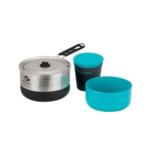 Sigma Cookset 1.1
 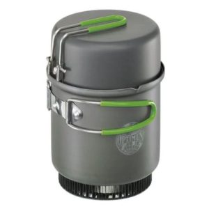 Elektra Fe Cook System (without BOB)
  Walking in the Drakensberg